Snowy North
Tuesday 23 September 2014
After getting updated information on the walk, I imagined that it may be a little unclear in places where the pad was, but nevertheless no real problem. However it worked out to be quite a hard walk, mostly because we had trouble finding where the pad was in one location and eventually ended up in thick scrub. The walk ended up being the hardest I have done in quite a number of years.
Getting to the start presented no dramas and it was handy having the road junctions in the GPS, as the South Styx road junction was unsigned. We did discover a quite new sign a few hundred metres from the track start indicating the end of the road, presumably because it was at a wide area for turning and parking.
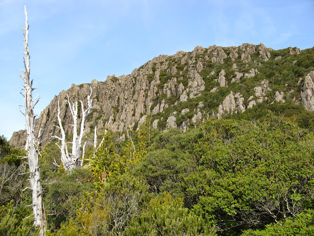
Locating the track start was easy, but then we took a while to find where it went for the next 50 metres or so until a marker was spotted and a pad. It was straight forward until a small cliff line at which point some uncertainty crept as to the whereabouts of the next marker. Eventually a pink tape was found in a Pandani thicket below a gap in the cliffs, and the assumption was made that the route went that way. However we were considerably mistaken and this became obvious when thick bush began to close in on us. We took the gamble that the scrub higher up would be more congenial, but this hope was soon dashed. A small rocky top was reached and the cliffs of Snowy North were directly in front of us, but a valley of thick scrub lay between.
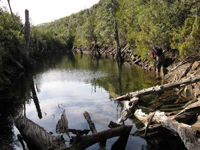


The 1:25k map was consulted and we noticed it showed the track passing close to a tarn and we took another gamble that the map was correct and headed the 100 metres to it. The tarn was substantial being about 60 metres long but quite narrow. There was even what seemed a sawn log there which gave encouragement and Neville scrambled around the edge to search whilst Greg and I attempted to get to the top of a ridge; our effort was aborted by a wall of scrub and we joined Neville at the other end for a hot drink and a bite to eat. It was now 10:50 AM and some 2½ hours since setting out.
It did not us long to discover that the track marked on the map was not correct and so we were left with more scrub to negotiate. For a short while this was relieved by a rock scree before commencing a steep pull up through more scrub, with the Bauera trying to push us back down. At one stage I leaned back against a small tree thinking to myself that “I just can’t get up here”, but a zig zag up overcame the problem. At a rock wall I tried to use some ledges but what lay in the rocky crevice ahead was too unknown so it was back to the scrub. However the ridge top was now quite close and a welcome break for lunch; it had taken us over 4 ½ hours to this point.
I had the track descent point marked in the GPS and we walked the 250 metres to verify that, then went to the Snowy North summit arriving there at 2:15, exactly 6 hours after setting out. The return walk was down a pad but nevertheless it was still somewhat scrubby and overgrown, but a dream run compared to the upward journey we had made. Once on the shelf where the track took a sharp turn I had some difficulty with spotting the pink tapes; being colour blind doesn’t help. Neville who was ahead had no such problem but Greg pointed them out to me when needed.
Arriving back after 3 hours walking and now starting to feel all the scratches on the arms. It was certainly the hardest walk I had done for quite a number of years.
The distance walked was 11.5k.
Here is the satellite image of our route with red line as our inward route to lunch time
Click the image below to view the photo album from the walk

After getting updated information on the walk, I imagined that it may be a little unclear in places where the pad was, but nevertheless no real problem. However it worked out to be quite a hard walk, mostly because we had trouble finding where the pad was in one location and eventually ended up in thick scrub. The walk ended up being the hardest I have done in quite a number of years.
Getting to the start presented no dramas and it was handy having the road junctions in the GPS, as the South Styx road junction was unsigned. We did discover a quite new sign a few hundred metres from the track start indicating the end of the road, presumably because it was at a wide area for turning and parking.
Locating the track start was easy, but then we took a while to find where it went for the next 50 metres or so until a marker was spotted and a pad. It was straight forward until a small cliff line at which point some uncertainty crept as to the whereabouts of the next marker. Eventually a pink tape was found in a Pandani thicket below a gap in the cliffs, and the assumption was made that the route went that way. However we were considerably mistaken and this became obvious when thick bush began to close in on us. We took the gamble that the scrub higher up would be more congenial, but this hope was soon dashed. A small rocky top was reached and the cliffs of Snowy North were directly in front of us, but a valley of thick scrub lay between.


I had the track descent point marked in the GPS and we walked the 250 metres to verify that, then went to the Snowy North summit arriving there at 2:15, exactly 6 hours after setting out. The return walk was down a pad but nevertheless it was still somewhat scrubby and overgrown, but a dream run compared to the upward journey we had made. Once on the shelf where the track took a sharp turn I had some difficulty with spotting the pink tapes; being colour blind doesn’t help. Neville who was ahead had no such problem but Greg pointed them out to me when needed.
Arriving back after 3 hours walking and now starting to feel all the scratches on the arms. It was certainly the hardest walk I had done for quite a number of years.
The distance walked was 11.5k.
Here is the satellite image of our route with red line as our inward route to lunch time
Click the image below to view the photo album from the walk
Comments
Post a Comment