Mount Faulkner
Wednesday 19 October 2016
Nomenclature - Mount Faulkner
Mount Faulkner was
suggested as a walk by Greg, but we knew that many parties had problems with
access. In fact, some reports indicated
that some property owners were downright nasty, however Greg was aware of a
walking club leader who had a route that avoided private land and that was to
be the way we would go.
After a perusal of the
map a possible route that went through the bush from a fire trail was to be
tried, but on arrival at that point the bush looked thick and we kept on the
fire trail to a ridge, hoping it would be more conducive. It had been mostly
sunny but no sooner than we arrived at this high point on the trail, the weather
changed and snow began to fall. This was a discouragement, but within minutes
it had stopped and sun returned, so we set off.
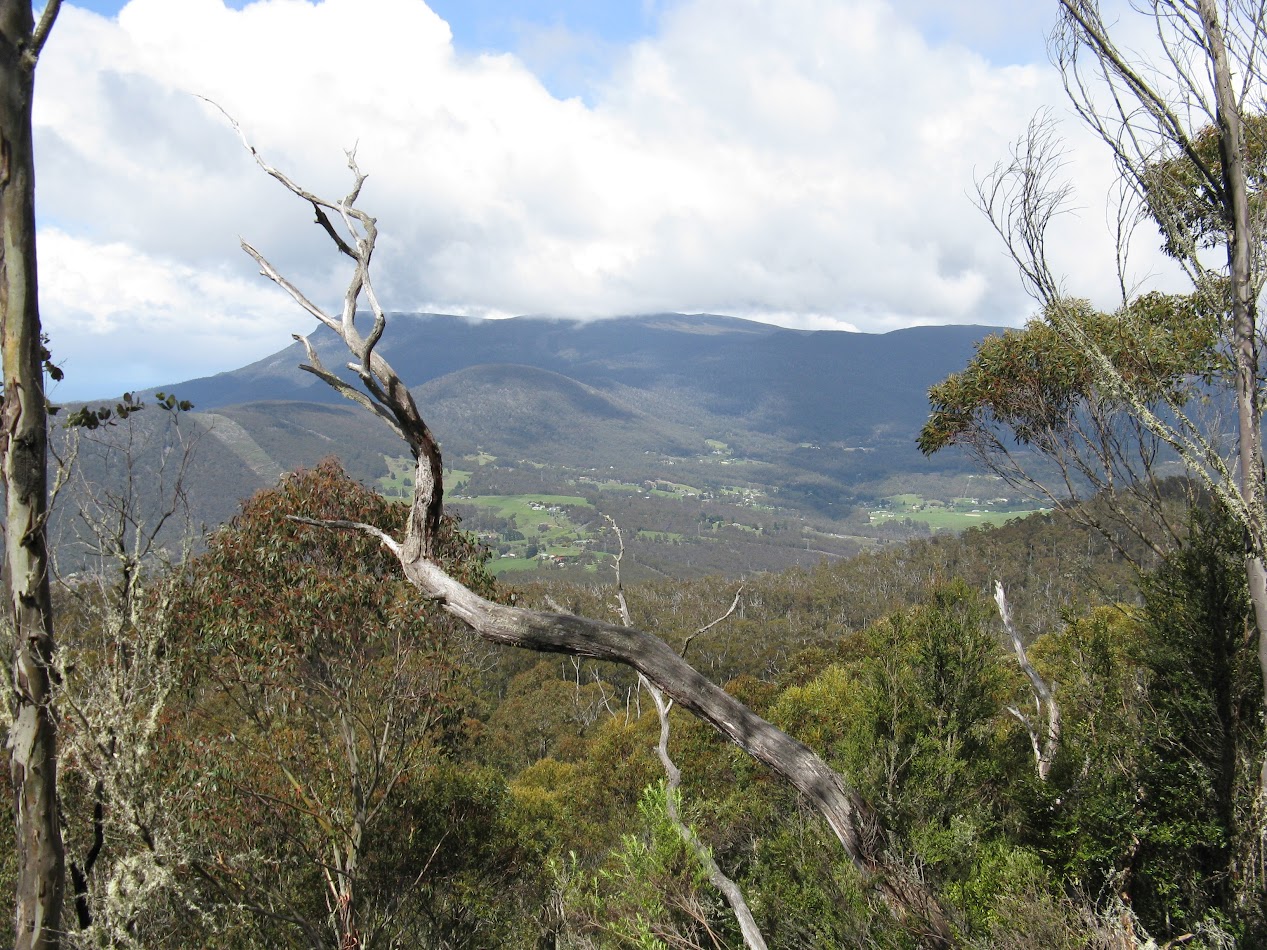 |
| Wellington Range beyond Collinsvale in the valley viewed from near the summit of Mount Faulkner More photos at this link |
Now this ridge route was
800 metres to the top and very soon after commencing it became scrubby but
generally not too bad. Then we met an area of large rocks and some thick scrub
which went on for some time. Just as we were in thick of it hail began and if
it wasn’t for the fact that Mount Faulkner was only 130 metres away I think we
may have packed it in. By the time we did reach the top our trousers were very
wet, but for a brief reprieve the day brightened up. Dark clouds however
foretold an end to this and sure enough hail by the bucket load began and we
began to feel cold and decidedly not keen to have lunch. Abandoning the top, we
headed back down finding a much less scrubby way. My fingers were feeling
really cold made worse by the need to grip hail covered rocks for support; Greg
K mentioned his hands so it wasn’t just me feeling it.
When the sun returned we
passed up the chance to have lunch and were keen to reach the fire trail first.
At least once there we wouldn’t be out of the wet scrub and trousers would at
le3ast begin to dry. During our quick lunch 2 quad bikes could be seen and, after
doing a couple of spins around, one of them headed our way. Someone said well at
least there is four us; but in fact the driver only wanted to check that we
were OK and then spun around and drove away.
To my way of thinking
it turned out to be quite a taxing under the conditions. Our route up was
slightly longer than return, about 7k as against 6.7k back. It took roughly
1:15 each way through the 800 bush section.
On looking at the map
and remembering John said his walk was quite long, it seems likely he continued
on the fire trail all the way to the fire tower then 300 metres through the
bush to the summit. The additional distance from our departure point would be
4.6k, plus the 300m through the bush from the fire tower to the summit, each
way.
 |
| Route taken to Mount Faulkner. Red is up blue is down. |
Nomenclature - Mount Faulkner
For information regarding John Pascoe Faulkner
(or Fawkner) and family, see Journal of Tasmanian Historical Research
Association Vol 4 Number 3 for article entitled John Pascoe Faulkner in Tasmania
by R C Sharman. Also spelt Falkiner in Century of Glenorchy, page 14.
Comments
Post a Comment